Lesson 5 is focused on the application of what the student's have learned over the past four days.
Supposed you lived in an area with streets laid out on a grid like the diagram below.
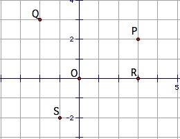
If you lived in a house located at point P in the diagram below, you could tell someone where you live by saying,
"From the crossing at the center of town, go three blocks east and two blocks north."
How could you describe where you live in relation to point P if you live at point P?
Mathematicians make such descriptions shorter by using a grid system and coordinates. The use use (3,2) for a house at point P or they would use (-2,3) a house at point Q. Point O is the center of the town so it is labeled (0,0).
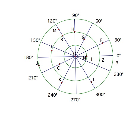
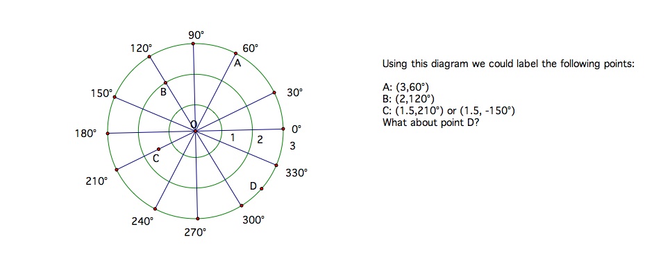
This grid system is not always the easiest way to describe a position. Mathematicians also like to define a point by a distance and an angle. If you were flying a plane and needed to know where another plane was located using the previous grid system would be difficult. Look at the following grid used for describing position by direction and an angle. For this example keep in mind that rotation in a clockwise direction is represented by a negative angle and rotation in a counter clockwise rotation is represented by a positive angle. Also, one complete rotation, all the way around once, is 360 degrees or -360 degrees.
**********************************************************************************************************************************************************
Student Exercises:
I. Using the previous city grid locate the following points.
a. A point T five blocks due west of the center of town.
b. A point U five blocks east and two blocks south of the center of town.
c. A point V two blocks west and one block north of point P.
II. Come up with your own city grid and give directions starting out at three different places and ending at the three different places.
III. Use the following grid and find the points coordinates.