
Global Positioning System
by: Jackson Huckaby
Today positioning is done with the Global Positioning System, or GPS. So the burning question is, how does GPS work?
The method behind GPS is based on triangulation. The goal of triangulation is to use 3 satellites to determine an exact point in space for an object in three dimensions: longitude, latitude, and elevation. Already we see an improvement in this method as compared to the LORAN system because we looked at that system on the ocean, making elevation null and void.
So how does triangulation work?
Lets look at a basic two deminsional example first with circles in a plane.
Lets pretend we have recieving Station A, Station B, and Station C.
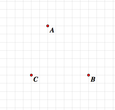
Attached to the leg of a backpacker in a desert of some other flat expanse is a receiver that communicates exact distances from the stations and nothing else.
The moniter is saying that the hiker is 6 miles from A, 5 miles from B, and 2 miles from C.
Where is our hiker?
Let us first represent all possible locations that are 6 miles from station A with a circle of radius 6.
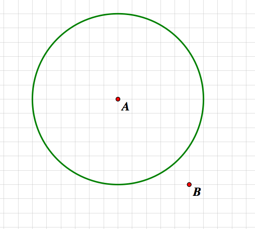
Our green circle represents all possible locations based soley on the information from reciever A.
Now we can overlap this with the information from reciever B.
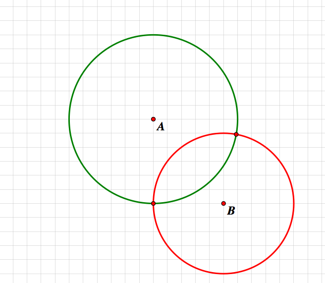
We now have the red circle representing all possible locations of the hiker based soley on the information given by station B. If we combine our knowledge we now have two exact locations for the hiker. So let us insert our knowledge about station C:
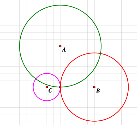
Now we can see that there is only one possible locationfor the hiker, and that is at the intersection of our three circles.
Lets kick it up a notch to three deminsions.
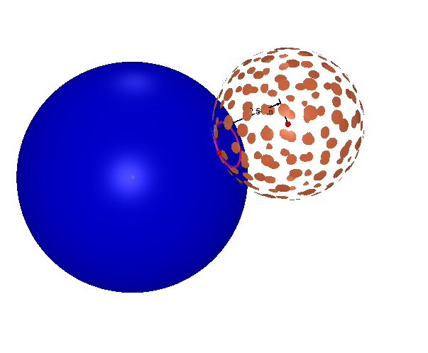
We are now attempting to locate a position based on the distances from the moving receiver and its location relative to the satellites in the sky. So we will think about one satellite at a time. We find the distance between receiver and satellite. Now that this distance is set, a sphere is created around satellite 1 in which all possible locations of the receiver can possibly be.
The earth is seen in dark blue. We can see the intersection of the earth and sphere gives us a pink circle of possibilities.
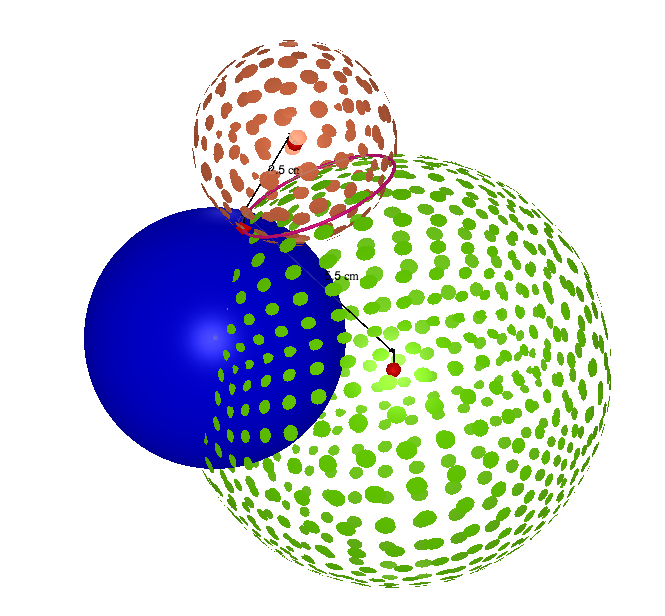
Next we can add another satellite into the picture. The distance between this satellite and our receiver develops another sphere of possibilities around satellite number 2. When the two spheres overlap, the intersection gives us a circle, which contains all the possible locations that our receiver may possibly be. This circle is displayed on our picture in pink.
Now to complete the triangulation, we add the distance to our third satellite. Once again, a sphere of possibilities is created. When this sphere is combined with the first two we develop 2 exact points where our receiver could possibly be located. We can reject one potential answer by omitting it because it is not realistic due to it being out in space somewhere. Therefore we are only left with 1 possible location for our receiver.
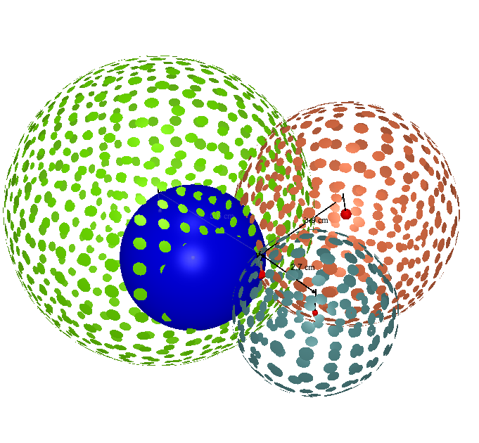
Some systems can use a 4th satellite in a similar fashion to further eliminate the last point that is a technical possibility. However, this points location is not on the surface of the earth so it is normally simply discarded as impossible.
Return home.